Reading List
Notes on Map and Compass Navigation from Charlie Harrington RSS feed.
Notes on Map and Compass Navigation
Prior to the shelter-in-place quarantine, my friend Jason and I had been going on what I like to call "sixth grade classtrips" to various nerdy sites of interest in the Bay Area. First on our list was the Nike Missile site, which is right over the Golden Gate Bridge in Marin. I'll share my notes on that one soon. Our next big classtrip was scheduled to be the Stanford Linear Particle Accelerator Center in Menlo Park (maybe you've seen the signs for this on the highway and wondered...), but that's first on our list once everything's safe again.
After the Nike Missile site, we decided to take a course on map & compass navigation through REI. Here's what we learned in four brisk hours standing on a field in Palo Alto:
Maps
Using a map is about using filters to reduce your search area
Download free USGS maps! Print online with Caltopo. Best scale is 7 & 1/2 minute (there are 60 minutes in a degree)
SCOPE acronym:
- shape
- color
- orientation
- proportion (aka distance)
You don't have to go in order of the acronym!
Shape
Look for valleys, ridges, hills with flat tops, gulleys, hills in a row (e.g. 3 hills in a straight line), shape of the tree line
Hidden Valley Ranch Salad Dressing
- Another acronym. Used by the "military"
- Hills Valleys Ridges Spurs Depressions
- These are the landshapes to look for on your map and in the area
Color
green = trees, white = not trees
How to tell if you're in trees? Look up, if you see branches, you're in a green area of the map
Sometimes white areas will have scrub brushes and plantlife, don't be confused
Sometimes the tops of green hills will have white scrub / chaparral areas
red or black indicates a human-made object
trails are often not on a map. Many of the surveys were done decades ago, before these trails
Orientation
Use compass to orient the map, then place the map on the ground. This allows you to walk around the map in any direction and see the same things in real-life as the map
Maps usually point North
Proportion (Distance)
Measured as the crow flies, not on the ground
Maps have a scale on them
You can use the string of your compass to trace a trail, and then make the string straight and taut to get the distance of a trail using the map's ruler / scale
Good skill to learn: look at object in the distance and estimate the distance. Use a range and keep getting tighter (e.g. it's somewhere between 10 ft and a mile away)
Make sure you know if your map is in miles or kilometers
Elevation
Measures vertical distance above sea level in feet
5280 feet in a mile
Contour lines have a standard elevation gap between them (e.g. 40 ft), but the land between them can fluctuate in real life as you pass through them (it's not a smooth linear ascent)
Maps have "index" contour lines that state their elevation
"Intermediate" contour lines don't state their elevation, but can be inferred from the index lines
When lines are close together = STEEP!
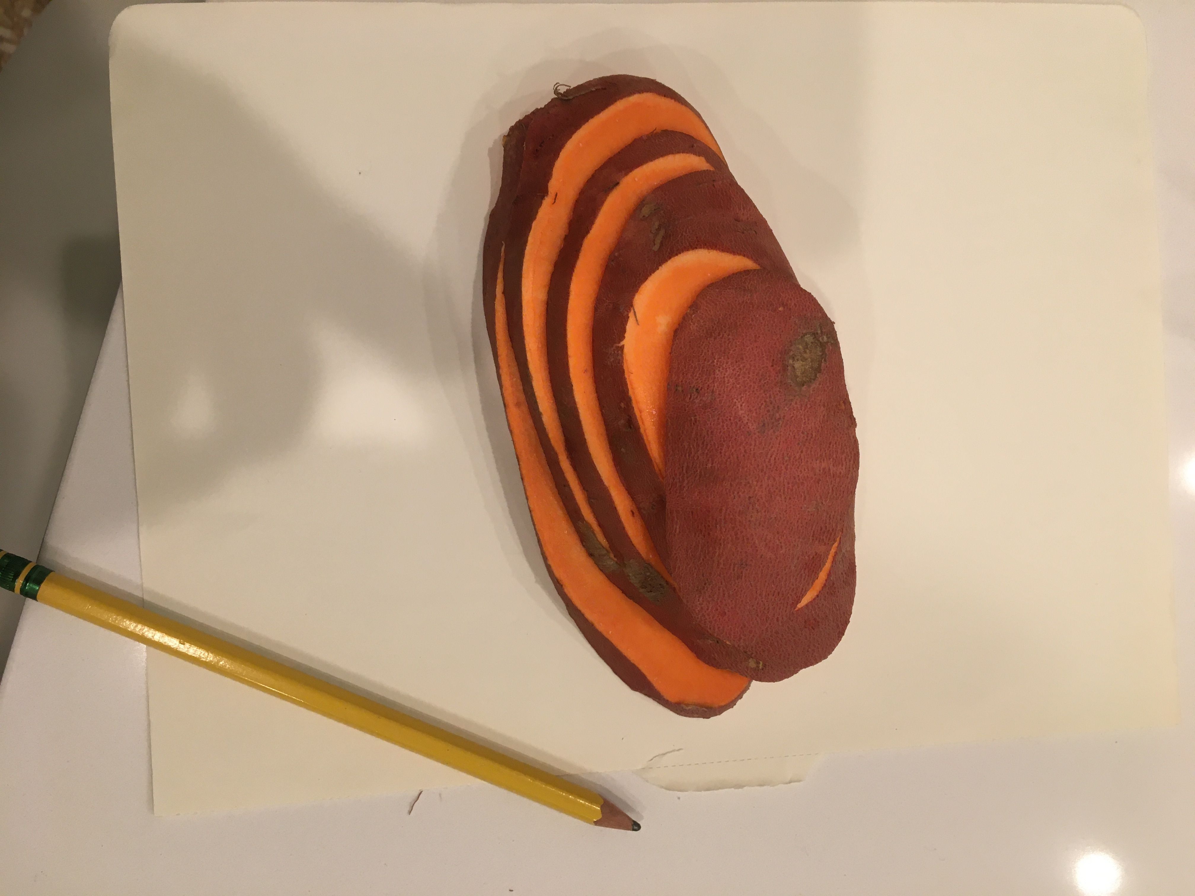
Fun experiment: slice a potato to measure contour lines! Note I did this when I got home, as you can see here:
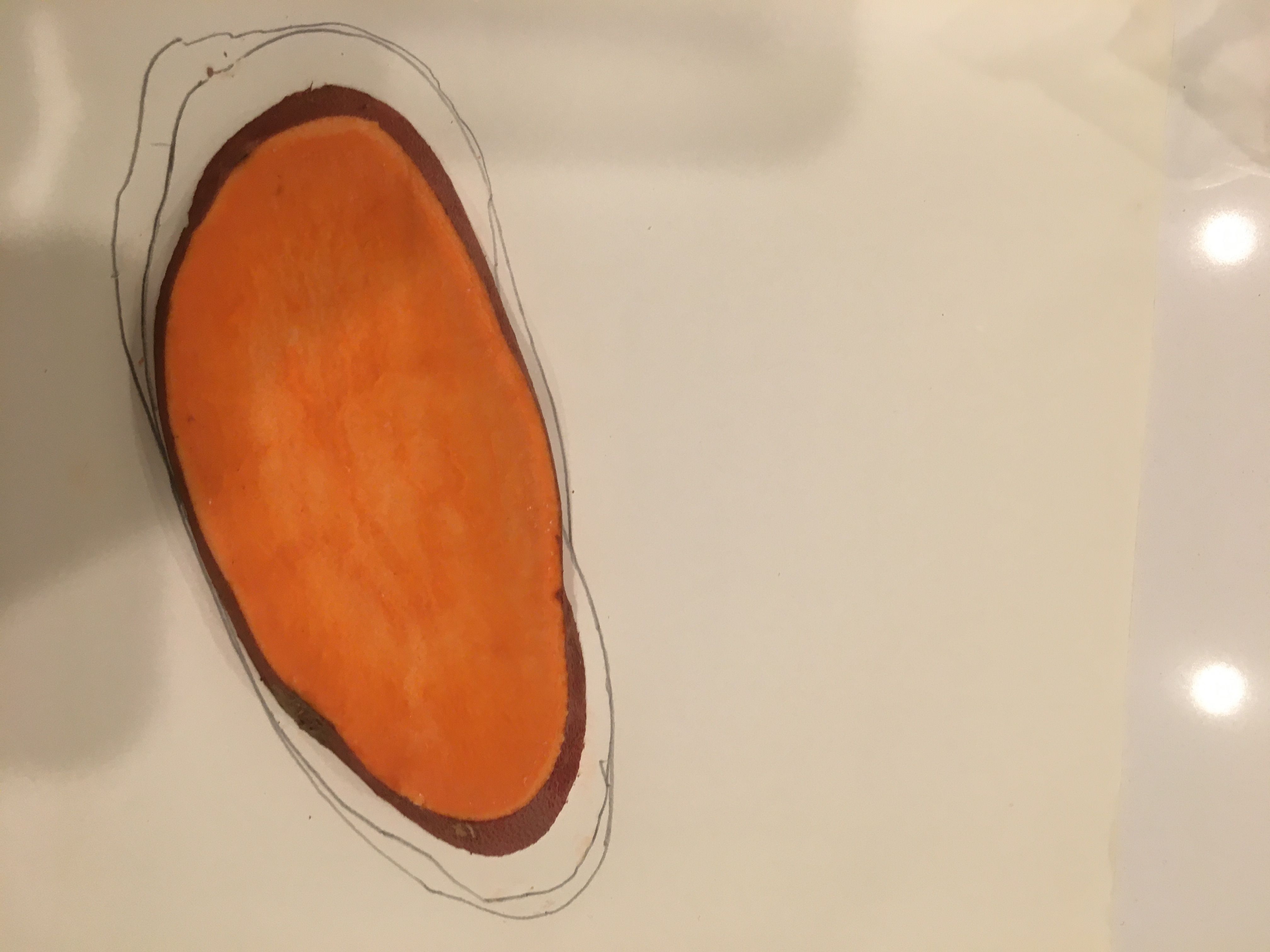
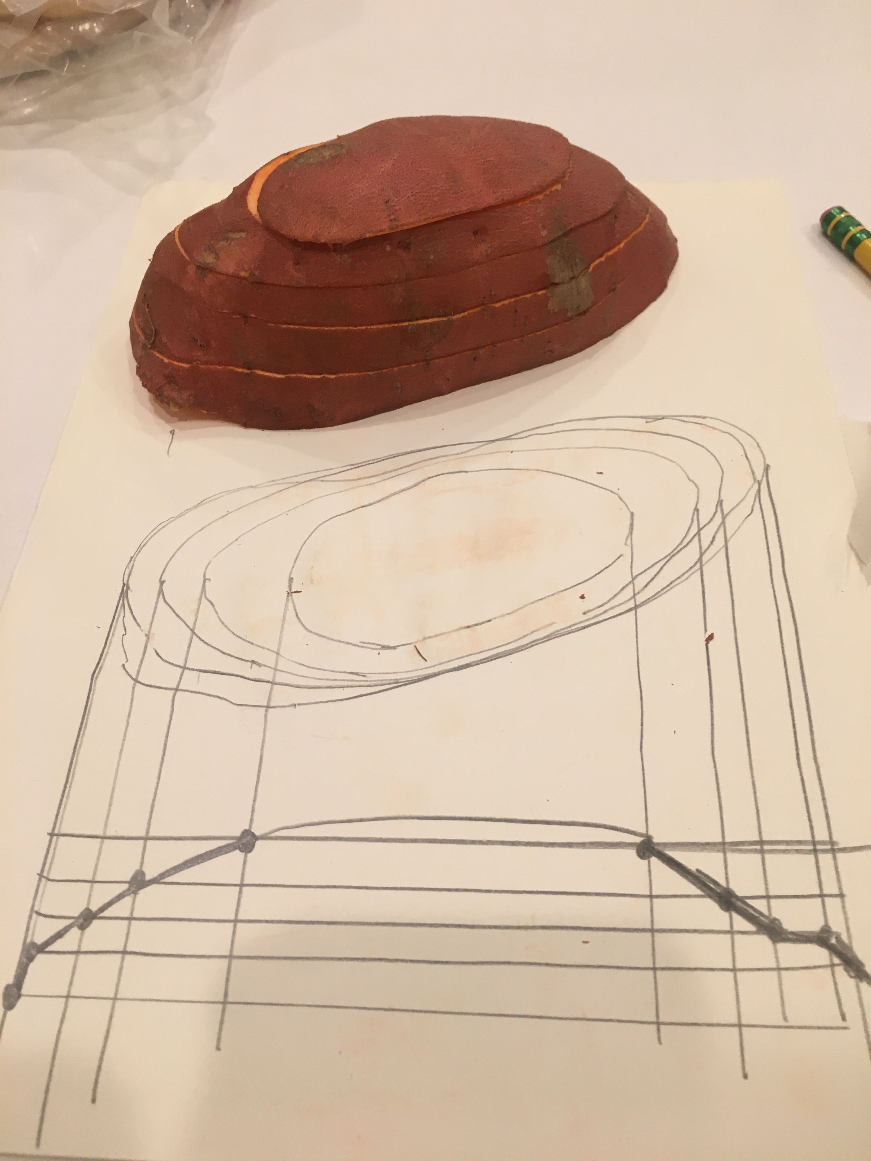
- Contour lines are shaped like upside down V when there is a small creek valley. The V points uphill, away from the water direction
- Spurs look like shallow U shapes
Compass
Four skills to learn:
Real World
- (1) Follow a field bearing
- (2) Take a bearing of an object
"Map World"
- (3) Find object on map and measure angle
- (4) Start with angle and draw on the map
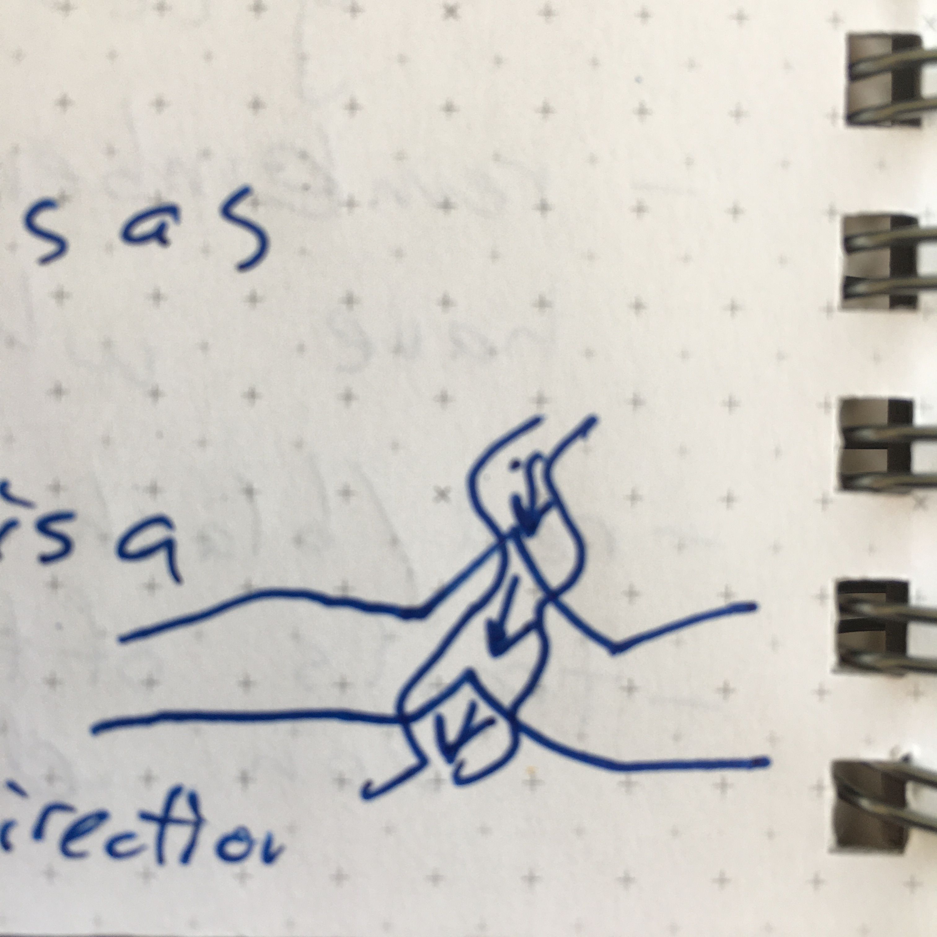
Angles are always measured clockwise
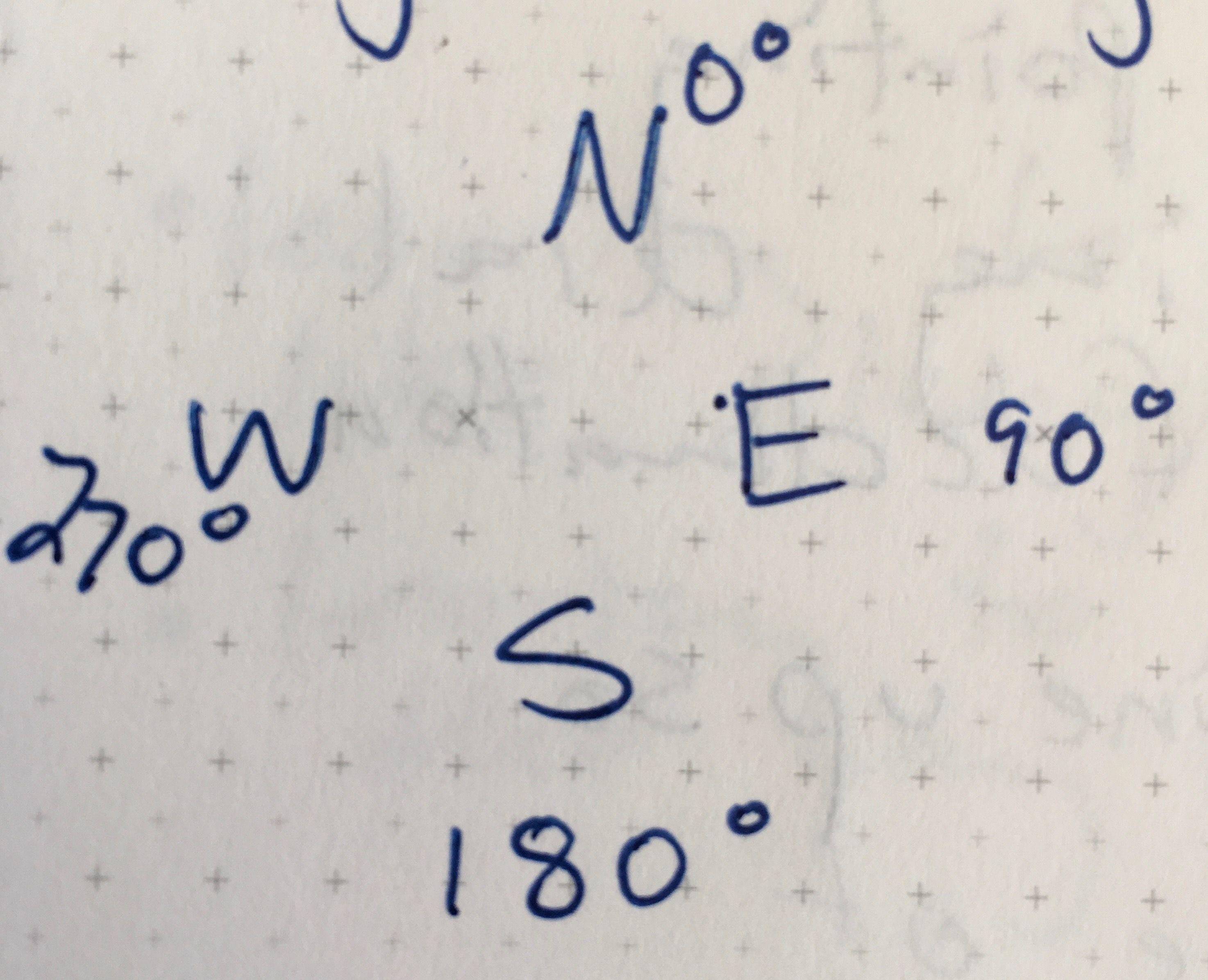
If you forget the compass directions, it spells "WE" left to right.
True north (north pole) vs Magnetic North (which can move around!)
Declination is number of angles from true north to magnetic north
Always keep your moving needle on the declination
Angle of declination needs to be known for your area (look this up!)
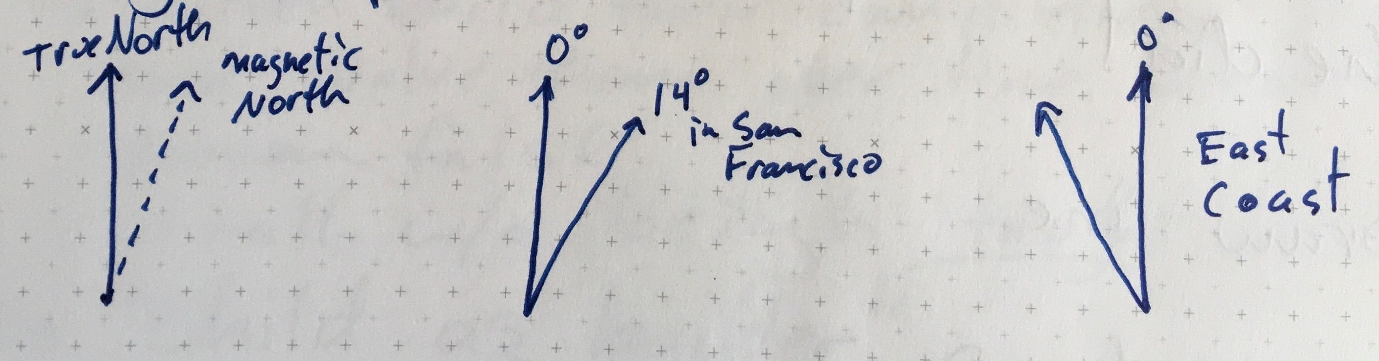
Angle of declination grows larger as you move north
A compass in the Southern hemisphere isn't going to work very well
North Star does point to true North (only object in sky that doesn't move as the Earth rotates)
Triangulation (my favorite part of the class!)
Brings it all together! This helps you "locate" yourself on a map.
General overview: Finding your location a map by taking three field bearings, making their angles, and then putting compass on the map and drawing a straight line with their angles
You definitely need to know exactly where the objects of interest are on the map for this to work (e.g. a mountaintop, a water-tower, etc)
Steps:
- Take bearing of an object by pointing compass at object and moving the dial until the needed is at the angle of declination
- Move compass to map and line it up so that it is pointing to angle of declination (but don't change anything on your compass dial!)
- Draw a straight line
- Repeat 2 - 3 times with different objects
At this point, you should have created a "triangle" where you are likely somewhere inside!